 |

A.J. Fuller | Historical archives | Underwater images/video | Exploration updates
The wreck in Elliott Bay currently believed to be the A. J. Fuller has never been positively identified. In 1988 and 1989, a side scan sonar survey of Elliott Bay was conducted to identify submerged cultural resources, and the results of this survey are published in US Army Corps of Engineers PSDDA Report, dated August 1988, entitled "The location, identification and evaluation of Potential Submerged Cultural Resources in Three Puget Sound Dredged Material Disposal Sites" (the "PSDDA Report"). The PSDDA Report states "we believe there is a reasonable chance that target 3 (is) the remains of the A. J. Fuller". The PSDDA Report describes target 3 as a large shipwreck, 170 feet by 40 feet at a depth of 220 feet. The PSDDA Report also notes that the length of target 3 is significantly less than the 229.3 feet listed in the A. J. Fuller’s Certificate of Registry. This discrepancy has never been resolved. In addition, Gibbs reports a barge (M. T. No. 6) sinking on December 31, 1949, in the approximate location of the A. J. Fuller (see Gibbs, James A., Shipwrecks of the Pacific Coast, 1957). As the A. J. Fuller is one of two shipwrecks listed by Washington’s Office of Historic Preservation as eligible for listing on the National Register of Historic Places, a resolution of this uncertainty is important.
June 2000:
SCRET visited the A.J. Fuller in June 24, 2000. As we arrived over the site, the VTS controller warned us by radio that a DOT barge was in the area dumping garbage and that we should be careful not to get under it. We could not help but wonder how little thought has gone into protecting this part of our state’s history.
We dropped a weighted line next to the shipwreck and descended down it on our scooters. When we reached the mud bottom at 240 feet, team 1 (Walter Jaccard and Mark Tourtellot) tied in a reel and followed a compass heading to one side of the shipwreck, which sits upright on the bottom. Team 2 (Andrew Georgitsis and Kevin Connell) followed close behind. Andrew had the video camera on his scooter. We ascended approximately 15 feet to the topside of the wreck and followed a 30 heading down the port side of the vessel.
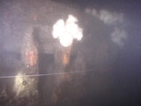
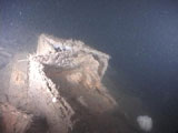
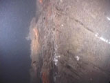
The sides of the wreck are intact, but contain large holes where the planking has fallen off, revealing the wooden ribs inside. Intact ceiling planks still cover most of the vessel’s interior. In places, the deck is littered with boxes and other debris. As we reached the stern, we observed that it had a curved "elliptic" shape similar to the A. J. Fuller’s stern.
[click any thumbnail for a larger image]
We continued up the starboard side of the vessel, passing what appeared to be blocks from the rigging on a sailing vessel. We passed over a large hole cut in the starboard side of the bow, which may have been made by the collision with the Mexico Maru. In this location we observed a large chain lying across the wreck, which was presumably lost by a commercial vessel that snagged the wreck with its anchor.
As we rounded the bow, we could see that it had the blunt, pointy shape of the A. J. Fuller’s bow and not the square shape of a barge.
We headed down the port side of the vessel and quickly reached our original tie-in point, indicating that we had made a complete circuit around the shipwreck. With our short bottom time almost gone, we scootered back to the up line and started our ascent. The dive teams spent 30 minutes on the shipwreck at an average depth of 230 feet (Max was 250fsw), followed by 65 minutes of decompression.
The team obtained some excellent video footage of the shipwreck that will be reviewed and evaluated by SCRET advisor, David Grant, a marine archeologist.
Get the Vivo Video here (5MB).
You can obtain a short, high-quality, albeit large (25MB) intro video here in MPEG format or QUICKTIME format.
Special thanks to our support divers, Miranda Alldritt and Tod Gunther, and our boat skippers, Jay Jordan and Aaron Garcia.
- posted by Walter Jaccard


